Shandong China Coal
Industrial & Mining Supplies Group Co., Ltd.
+86-17753785400 contact@chinacoalintl.com


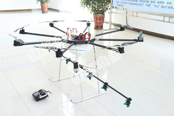
Flight Planning: Before the Agriculture Uav Drone takes off, a flight plan is created using specialized software. The flight plan defines the area to be covered and the specific flight path the drone will follow. This planning ensures efficient coverage of the fields and minimizes the risk of missing critical data.
Takeoff and Navigation: Once the flight plan is uploaded to the Agriculture Uav Drone and all pre-flight checks are completed, the drone takes off from a designated location. It uses GPS (Global Positioning System) and other navigation systems to follow the predefined flight path accurately. Some drones can also use RTK (Real-Time Kinematic) or PPK (Post-Processed Kinematic) systems for more precise positioning.
Data Collection: Agriculture Uav Drones are equipped with various sensors and cameras to collect data during flight. Common sensors include RGB (Red, Green, Blue) cameras for capturing visual images, multispectral cameras for analyzing plant health, thermal cameras for detecting temperature variations, LiDAR (Light Detection and Ranging) for measuring topography, and NDVI (Normalized Difference Vegetation Index) sensors for assessing crop health.
Crop Monitoring and Analysis: As the drone flies over the fields, the sensors capture data related to crop health, growth, stress, and other relevant parameters. This data is transmitted to the ground station or stored on the drone's onboard memory.
Real-time Feedback: Some Agriculture Uav Drones are capable of providing real-time feedback to the operator on the ground. This feature allows farmers to monitor the data as it is being collected, enabling quick decision-making and on-the-fly adjustments to crop management practices if necessary.

Data Processing and Analysis: After the drone completes its flight, the collected data is downloaded and processed using specialized software. Image stitching and data analysis algorithms are applied to create high-resolution maps and actionable insights. For example, multispectral data can be used to generate NDVI maps, which indicate areas of healthy and stressed vegetation.
Precision Farming: The analyzed data provides valuable information about crop health, soil moisture levels, weed infestations, and other factors influencing crop growth. Farmers can use this information to implement precision farming practices, such as targeted irrigation, variable rate application of fertilizers and pesticides, and early pest detection.
Remote Sensing: One of the significant advantages of Agriculture Uav Drones is their ability to access remote or difficult-to-reach areas of the farm, which may be challenging for ground-based monitoring. Agriculture Uav Drones can cover large areas efficiently and provide a comprehensive view of the entire farm.
Post-Analysis Reporting: The processed data and generated maps can be used to generate reports and insights for farm management. These reports help farmers make informed decisions about crop planning, resource allocation, and overall farm performance.